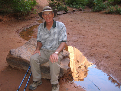
The trail was four miles round trip and included seven creek crossings each way. Luckily I brought my hiking sticks or I wouldn't have been able to do it. Ron, however, is sure-footed as a goat.

Once we arrived at our destination, I had no idea how to photograph this huge bridge. It's at the end of a side canyon and close to a cliff face. It was also in the shade, although the surroundings were in the sun. You see my problem.

I finally gave up, but I did like this shot of the bridge reflected in the water that created it.

Here Ron poses next to the tiny stream currently flowing under the bridge. I guess there must have been a lot more water sometime in the past.

Today, Diana, Phil, Ron, and I went into Arches NP and hiked the Devils Garden trail - my favorite hike in the area and, maybe, anywhere. Ron asked why we keep hiking the same trail and I said, "Cause we like it!" He's more an explorer type.
Here the three of them lead the way down the nicely graveled beginning of the trail.

That nice trail goes 8/10 of a mile to Landscape Arch which at 290 feet is considered the longest natural arch in the world. In 1991, a 180-ton slab fell from the right side of the span. In 1995, two more smaller sections fell. You have to wonder if total collapse is imminent - you can see it's smoking in the picture. :-)

Continuing past Landscape Arch, the trail passes nearby Wall Arch, which collapsed during the night in August of this year. Here's what remains.

The Park Service had to move the trail because the debris covered it. It's a good thing it happened at night!

Diana has a great 'before' shot on her Flickr site. To see it click here.
This is my favorite part of the hike. Arches is filled with rock structures called 'fins' which erode into the famous arches. This section of the trail goes over one of those fins - not for those afraid of heights. The view inspires a feeling of wonder and gratitude that such a place exists.

At the end of the second mile is Double O Arch, so named for obvious reasons. We climbed through that lower O to reach the tripod spot (Diana's name for the spot where everybody takes a picture.)

For our return we decided to take the primitive trail which adds a mile. It was a bit more challenging, but we made it. On the way, we took a side trip to Private Arch. (We all agreed that if they wanted to keep it 'private', they shouldn't have put up a sign.) Here Ron climbed up the fin to sit on top of the arch. Didn't he read about Wall Arch?

Here's Diana near the end of the primitive trail. The hardest part was not scrambling over rocks, but the 1/4 mile uphill through deep sand at the end. We were glad to get back to the main trail. I tried to convince everybody we should run around the last corner so all the other people would think we ran the whole way, but nobody would go for it.

Great memories of Arches. Thanks!!
ReplyDeleteGreat pictures! I sure do look pooped at the end.
ReplyDelete