Thursday, October 31, 2013

Prescott

We decided to spend a few days near Prescott, AZ, where we experienced an unusual hassle finding a place to stay.  Prescott is surrounded on three sides by national forest, so I didn't expect a problem, but stuff happens.  Prescott National Forest only allows dispersed camping in designated places.  We disconnected the car and checked out a few of these spots.  Wow!  The roads to these unbelievably UNlevel, tiny spots were scary, to say the least.

Okay, no problem, there are three national forest campgrounds close to town. Unfortunately, it happened to be a Friday, and the first campground was completely reserved.  I've probably already mentioned how I feel about reservable campgrounds.  Campground number two was non-reservable (Yeah!), but was closed for the weekend because it was booked out to some group (Hey! What happened to non-reservable?) Campground number three was just right - too bad we didn't go there first.  Yavapi campground is on Granite Basin Road with giant sites and lots of sun for the solar panels.

Nearby are the Granite Dells, a pretty area with lots of cool rock formations.

We did some rock scrambling.

The rocks looked like somebody scribbled on them - pretty cool.

One more.

And speaking of sights, we got a kick out of this one.


Sunday, October 27, 2013

Gettin' Our Kicks

On Route 66, beginning with the museum in Kingman, Arizona.  In the early 1900s, the federal government realized a need for a national highway system and by 1937, Route 66 was completely paved from Chicago to Santa Monica, California.  Since then much of the road has been incorporated into the interstate system, but in western Arizona remains the longest continuous stretch of the original road.  From the state border in Topock to Ash Fork is 160 miles of nostalgia.

The museum gave the history of the route from pioneer times, but I’m going to jump ahead to my time.  I don’t know if the Studebaker was a reliable car, but I just love the look of it.

This one even had a high tech air conditioner. 

I’m sure everyone of my generation remembers the Burma Shave signs.  We would get so excited when we spotted a set of the signs along the road.  What a genius idea Mr. Odell had when he came up with that one.  Here’s a short history if you’re interested.

Along with a few of the verses you might have seen along the road.

I didn’t realize they even got involved in the war effort.

When we headed east out of Kingman, we took old Route 66 instead of the interstate.  I expected to see lots of cool old motels and diners like this one in Kingman.

But I guess enough time has passed that little remains from the road’s heyday.  We did enjoy the very interesting Hackberry General Store.

There was some rusty stuff for Diana.


And the scenery was nice in places.  The railroad shared our route through the hills.  I swear we saw seven trains in the 85 miles we traveled.  As an ex-railroad employee, that makes me very happy.

We had a close up view of the Aubrey Cliffs. 


But I was really excited to see some Burma Shave signs.  Here, pretend you’re driving along Route 66 about 50 years ago.


At Seligman, Route 66 nears the interstate and the town really celebrates its history with places like the Roadkill Café.

I’m glad we took ‘the road less traveled’.  It brought back memories of road trips we took many years ago.  Was it really a simpler time or does it just seem that way? 

Sunday, October 20, 2013

Onward

Leaving Pahrump, we took three days to drive the 57 miles to Las Vegas when we stopped halfway for two nights.  The road runs through a lot of BLM land so we just found a spot off a side road.  We were in the Mojave Desert which is known for one of my favorite trees - the Joshua Tree.

As a member of the Yucca family, it's not really a tree, just grows like one.  Like my other favorite tree, the Giant Sequoia, it can live a long time.  With an extensive root system, it can survive the desert for hundreds of years, possibly making it to 1000 years old.

This one is down, but not out.

We moved on to Las Vegas where we were meeting some of Ron's family who came in for a Jimmy Buffet concert.  It seems Las Vegas has been overrun with Bighorn Sheep.

And wild horses.

Of course we've been here several times before so I'm not going to repeat myself.  For a glimpse of the Fremont Street craziness, here's a previous post.  We stayed overnight at The Orleans Casino which has posted some unfriendly signs since last year.  But nobody threw us out.  It's only a mile or so off the Strip and we had a sunset view of New York, New York from the parking lot.


Tuesday, October 15, 2013

Death Valley on the Fly

From Lone Pine, CA, we headed east right through Death Valley National Park.  Although the Mountain Directory said some alarming things about the curves and grades on this route, Ron was not deterred.  We decided that I would follow him in the car, so at least he wouldn't have that to drag behind.

Soon after entering the west side of the park, CA 190 starts downhill, going from 5200 feet elevation to 1500 in about 15 miles into Panamint Valley.  This doesn't sound too bad, but there were a lot of curves and no shoulder.  The rocks were right at the edge of the pavement.

Interestingly enough, I took several pictures of Ron and in every one, he was smack in the middle of his lane.  Actually I was the one all over the road while I snapped pictures out the window.

Once into the valley, we pulled off to take a few deep breaths.

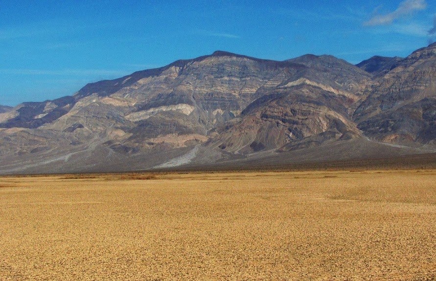
The ground has that interesting cracked, parched look.

But wait!  Next the road climbs back up to 5000 feet, then drops down to sea level, all in about 20 miles.  But we were pleasantly surprised to find more gradual curves and a bit of shoulder, along with some pretty colorful scenery.

Since the park was closed due to the government shutdown, the side roads to various Death Valley attractions were closed.  This was particularly unfortunate, because it was freakishly cool in the low 70s.  It would have been great to do some hiking.

We couldn't go to the lowest point in North America, Badwater Basin at 282 feet below sea level.  But we got close.

And looking out over the salt flats, it looked like I remember the Badwater Basin looking.

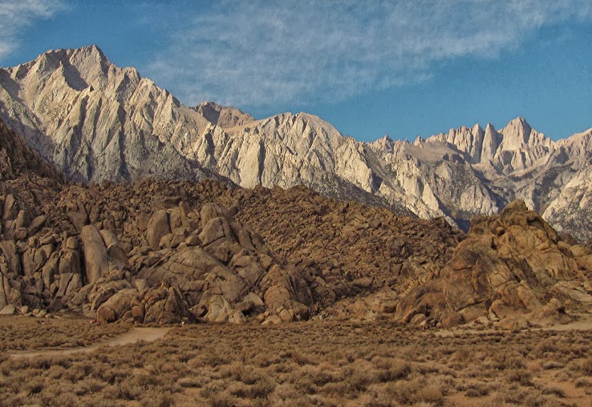
Since the road out of the valley is more gradual, we hitched the car back up and, hold on to your hats, I drove.  The colors in the hills were spectacular, but Ron fell down on the picture taking.  He did get this shot.

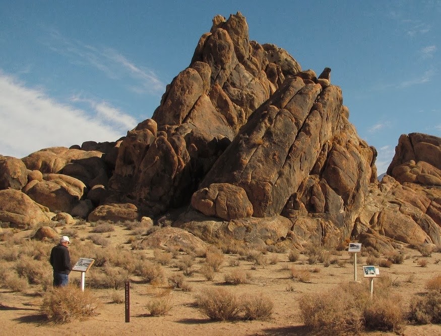
Once we left the park and were back in BLM land, we stopped at a great spot for the night.

It was like a mini version of the 'Slabs' with the concrete pads, but deserted and clean.  The GPS coordinates are 36.33898, -116.60042, but if you go, watch out for the rebar sticking out of the ground.  I almost ran over one that I didn't see.  That would have been the end of my driving - ever!


Friday, October 11, 2013

Love Those Hills

The last stop on our trip south along US 395 was Lone Pine, home of the Alabama Hills.  Why are they called that?  Well, I don't know, but I just love them.

Nestled at the base of the Sierra Nevada mountains, the Alabama Hills are a mixture of jumbled rocks and hills.  Many Western movies where filmed here, most before I was born.

Every year about this time, they have a Film Festival to celebrate.  This year's theme is 'Lone Pine, where the real west becomes the reel west.'  Catchy, huh?  For the event, they place signs in the Hills, showing where various movies were filmed.

You read the sign, look up, and there is the very rock formation that was in the movie.  I LOVE this!

Here's one of the signs showing a scene with the stunt doubles for Roy Rogers and Trigger.

I almost expected to see a horse appear to jump over Phil's car.

Probably the most photographed formation in Alabama Hills is Mobius Arch.  With proper framing, you can see Mt. Whitney through the arch.  Mt. Whitney, on the far right, is the highest summit in the lower 48 states at 14,505 feet.
                             
(I know the one on the left looks higher, but that's just because it's closer.)

There's another smaller arch nearby and, after taking our picture, Diana worked hard to get the perfect shot there too.

While Ron thought it looked like a good place to take a nap.

One more shot of some of the cool rock formations.  This area reminded me of the 'fins' in Arches National Park.

We stayed in the Lone Pine area for three nights, but on the last night we did something we had never done.  We spent $36 for a site in an RV park.  Imagine $36 for one night!  But we did manage to justify the expense.  First we really needed the use of an RV dump (I know, TMI).  The only dump in the area (and believe me, I asked everywhere) was at this RV park and cost $10 to dump and $10 for water.  So we decided for the extra $16, we would just move in for the night.  Then we found out they have free coffee and muffins in the morning, worth $6 at a conservative estimate.  I didn't have to turn on the generator to use the microwave, maybe another $1.  It was really cold and we used our little electric heater instead of the propane furnace - probably another $1.  So we figure it only cost us $8 for the night.

The next morning, on our way to gobble up those muffins, we noticed the mountains had gotten a picturesque coating of snow overnight.


Wednesday, October 9, 2013

Strike Two

In our quest for the perfect lake with the perfect trees, Diana and I headed up to South Lake.  This is the picture from the parking lot from when we were there 9 years ago.

This is what it looked like the other day.
Another lake gone dry and they need to cut down the trees blocking the view.  I know that sounds ridiculous, but a lot of people never go past the parking lot.

But we, being the intrepid photographers that we are, headed up the trail to search for a better view.  There were a few colorful aspens, but they were definitely past their peak.

Ah, there is some water in the lake, but it's way, way down.

The water level marks in the sand show the sad story.

We were joined on our drive by the antique cars which were participating in a 'poker run.'  It was really a strange sensation to be in the midst of all these old cars - like some kind of a time warp.

Once again we found more colorful trees on our trip down the hill.  This waterfall surprised us.  It didn't seem to have any origin.