Sunday, September 26, 2010

What a Race!

After our lovely stay up at 7600 feet at the edge of the Rim, we headed back down to Mesa and the heat. It's still reaching around 100 degrees every day - I can't believe it. We're back to our normal routines - walking the mall, swimming, eating out,

sewing Christmas stockings,


sometimes even taking an evening walk when it falls below 90,


and probably watching too much TV. Tonight I watched one of my favorite shows, The Amazing Race. The tourist in me has always liked to see where they go around the world and the challenges are entertaining. But this episode added another level - humor. The teams went to England which seems tame enough, but the humor started with the stick shift rental cars. One lady pretty much burned out the clutch and another left her partner running after her when she followed the advice to 'just give it more gas.' I just laughed and laughed when they had to 'storm the castle' and the people on the battlements kept throwing dirty water down on them. Then they had to catapult melons at a suit of armor and one of the melons somehow shot backwards and beaned the contestant. (Okay, that sounds mean to laugh, but she was okay and laughed later about it.) But my favorite was when they had to cross the moat in these little boats that looked like half a giant walnut shell and they kept sinking. That never got old. If you missed it, here's the link to watch it online.

And how pathetic am I that I'm writing about a TV show?

Saturday, September 11, 2010

Whew!

One day I decided to take the trail by our campsite and see where it went. I knew it headed down the Rim, but I thought I could handle it.

The sign at the trail head was rather discouraging.


All that fuss over a little tree?


Most of the trail was really nice, although I could understand how it would become a running wash in the rain. But who hikes in the rain anyway?


Ron would have been whipping out the pruners and doing some trail clearing here.


Even in the woods, there were some pretty wildflowers. I think this is a wild geranium.


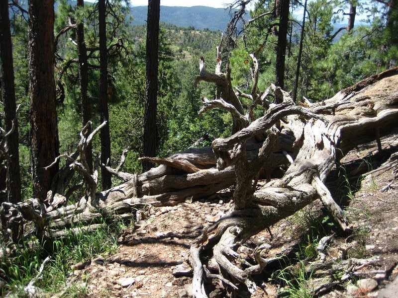
Okay, the fallen trees are getting bigger.


As I was making my way down the trail (and not really thinking about the return trip back up), I became aware of an odd sound. Of course the first thing I thought was 'BEAR!', but I realized the sound might be a hiking stick. Since I don't think bears have developed opposable thumbs yet, I felt pretty safe. (And, yes, all this did go through my mind.)

Well, sure enough, there was another crazy hiker on this trail, this one on his way up. As startled as I was to run into him, I think I took ten years off his life when I spoke since he hadn't heard me coming. I saw him visibly jump. Let that be a lesson - don't listen to an IPOD while hiking.

He told me I was close to an area where the woods opens up for incredible views. Sure enough, just a little farther and I could see the edge of the rim where I started.
Humm, maybe I should turn around. I checked the GPS and I had come down 800 feet. Gee, it looks like farther.

When I started back, I couldn't believe how breathless I was. On the steeper sections, I swear I was stopping every 20 feet! What a wimp! I guess walking the air conditioned mall at 1000 feet, even at a pretty good clip, does not prepare you for hiking uphill at 6800 - 7600 feet. I don't know how the rest of you do it!

During one of my stops, this white-breasted nuthatch entertained me. (Sure, he's there - right in the center of the picture.)
But most of the time I was too busy breathing to take any pictures. I even called Ron to tell him not to expect me any time soon.

I did finally make it back up and, although it seemed like forever to me, I was only gone about 2 hours. I figure it was only about a mile each way - 1/2 hour down and 1 1/2 hours back up. Let's see, that's 2 mph going down and 3/4 mph back up. Wow! I could have crawled faster!

I thought I would be dead tired the rest of the day, but after an hour or so, I was actually very energized! I couldn't even wind down to sleep that night.

I'll leave you with one last picture from the top of the Rim. What a spot!

Wednesday, September 8, 2010

More at The Rim

The Rim Lakes Recreation Area isn't called that for nothing - there are three nice lakes there. Before we left Show Low, Ron purchased a fishing license hoping to have a chance to use it. One morning he loaded up the fishing gear and his kayak paddles and we took off for the biggest lake, Willow Springs. We couldn't believe it! Although there was no wind at the RV, the wind was actually creating waves on the lake. Doesn't he look disappointed?


Instead we stopped at the three overlooks. Since we are not afraid of heights, we immediately went to the edge and looked over. However when I backed up to take Ron's picture, I did feel a little nervous, because I am afraid of falling and that rock doesn't look too secure.


Then we checked out another of the pretty lakes, Woods Canyon. We were happy to see the wind had died down (or maybe it was never there), but Ron felt he had missed the time frame for catching the early fish. Besides, he was hungry for lunch. So we decided to try again in late afternoon.

We were thrilled to see a bald eagle catch his/her dinner. What a sight! I haven't seen too many of them, so I was too excited to try for a picture.

Finally Ron was ready to catch dinner.
Sadly, he didn't catch anything, but, hey!, he looked good!

While I was waiting to help him clean his catch (yeah, right, that will be the day), I watched this couple who had a really unique way to back the boat trailer down the ramp. Every time the trailer got off track, the guy picked it up! That must be hard to do when the boat is on it!


I'll leave you with a sunset. I could have composed it better if I was willing to brave the evening mosquitoes, but I just snapped it from the RV.

Saturday, September 4, 2010

Playing Around

The August edition of Sunset magazine had an article about things to do around Payson. (Yes, not only do we now have a house, but I even subscribed to a magazine. Shocking!) While we were in the vicinity, we took the car and checked them out. First was the Tonto National Forest Paleo Site where you can dig for thousand-year-old fossils and keep what you find. We had a little trouble finding it since we were heading west and you can only get to it driving the other way. It's a large parking lot on the south side of 260 about 16 miles east of Payson. It actually does have a sign, and we had been by it many times, but we were always checking out the parking lot wondering if we could overnight there. (The answer is no, we wouldn't want to. It's on a section of SR260 with a steep hill and the truck engine brakes would be too noisy.)

Our big discovery was that we are not paleontologists. There are probably fossils there, but we have no idea how to find them. My excitement for the day was finding a few pretty rocks for my garden in Mesa. My thinking is since you can take the fossils, they wouldn't mind me taking some rocks.


And we admired these interesting wild flowers. Cute, huh?
Sunset magazine also mentioned Tonto Natural Bridge State Park, which is about 11 miles north of Payson on SR87. According to the magazine, this park was due to close the end of this month, so we had to go see it. (Actually, the park has received a stay of execution and will be open for another year. By then perhaps the Arizona budget problems will be solved. Yeah, right!)

This natural bridge is made of travertine - the rock that grows.


We walked down the Waterfall Trail to see the growth in action. Slowly, microscopic layer by layer, the minerals build up on plant life and turn to stone through a process of deposition and evaporation. Or so the sign said. I just thought it was pretty.


Oh, look! They have bears here. One stepped in the wet cement.


The natural bridge is believed to be the largest travertine bridge in the world - 150 feet wide, 183 feet high and 400 feet long. Natural Bridge of Virginia is higher at 215 feet, but not as wide or long.

We had a major disappointment when we discovered the trails down to Pine Creek were closed. Some silly thing about a safety inspection which could cause them to remain closed for awhile. Call first - 928-476-4202. The overlooks were nice, but I am always more impressed looking up at a bridge (and we didn't get any discount on the $5 a person entrance fee.) Nevertheless, I'm glad we saw it.

The travertine can form stalactites like those found in caves.


This is the view from the top of the bridge. It's a lovely area and a nice drive from Payson. The road into the park has a 14 percent downgrade, meaning I thought about those rocks in the trunk on the way back up.


On our way out we came across this cowboy. I had to wait for the cattle to move so I could get the pretty horse. It would have really been exciting if he had roped one while we were watching. The poor dog looked really tired.

Wednesday, September 1, 2010

The Rim

We planned a late departure on Sunday because we had already researched our new destination and wanted to arrive after all the weekenders had gone. Maybe we waited a little too long since it looked like we were heading into a storm.

However, we only hit a light drizzle and it cleared up before we arrived at our journey's end. Although I don't always share exactly where we are parked, this place is unbelievable and I'll make an exception.

Arizona 260 between Heber and Payson is a spectacular drive. Driving east from Payson, you are treated to views of the Mogollon Rim, the edge of the massive Colorado Plateau. Thirty miles from Payson, you arrive at the top of the Rim. Stop at the visitor center, which is just east of mile marker 282, but not well marked. They have plenty of parking and this wonderful view.

That is Four Peaks in the distance which is near Phoenix.

Pick up the Rim Lakes Recreation Area brochure/map which shows all the Forest Service campgrounds in the area. BUT if you're like us - cheap and don't mind driving on dirt roads - the important information on the map is the list of bookdocking sites.

Now here's the really important part - write this down. We have done all the research and the best boondocking area is along FR9350. The road is not too bad, it's right along the rim, there are 42 huge spots scattered along the 1 1/2 mile road, and, of course, it's FREE! You do have to pay to dump (both tanks and trash), but water is free and nearby (about 3 miles).

This is the one that was perfect for us - lots of sun, satellite TV friendly, good phone service. We're across the road from the actual Rim. We passed on that side because of the wind factor, although it was a tough call.


We took a walk down the road and liked the sun/cloud show.


The next morning, it was obvious we were actually in the clouds at 7600 feet. The day continued to be rather dreary.


But the following morning was perfect with just a few clouds in the distance. This is the view just across the road from us.


I went for a hike by myself since Ron was not feeling quite up to par. Hey, I hope this isn't bear scat! (After seeing the picture, Ron said it looked like elk to him.)


I took the trail to Carr Lake which we had been told wasn't really a lake. I assume this is it.


I just liked the look of this stump and fern grouping.


Hey! There is some water in Carr Lake! There were lots of interesting tracks around the pond. I didn't see any bear though.


I circled around and came back to the rim. Yes, you're going to see a lot of pictures of it, although my photos don't do it justice. It is just magnificent.


When I got home, I found Ron fixing the potholes in our drive. I guess he was feeling better.