Monday, August 17, 2015

Still Running

Upon leaving North Cascades NP, the road climbs for 15 miles with, what is reported to be, gorgeous views of the mountains.  Unfortunately, this is what we saw.

When we arrived at Rainy Pass (4855 ft.), the smoke was mostly gone so we decided to take a short hike to Lake Ann.  I guess trees really do clean the air, because we couldn't even smell the smoke while hiking through the woods.

Is this the lake?  Did it dry up due to the drought?

No.  Instead it seems I was a quite a bit off on the length of the hike and we continued on our way.

After about 2 miles and 850 ft. elevation gain, we reached our destination.  Hum, not exactly picture perfect.

And back we went.

Next stop was the overlook at Washington Pass, the high point of the drive at 5477 ft.  The views were amazing, even with the smoke.  Here's Liberty Bell Mountain.

I know the pictures are awful, but it actually looked a lot better in person.  I guess the camera accentuates the smoke.

We passed up the first two national forest campgrounds on our way down the hill and settled in at the third.   Early Winters campground was perfect.  We had sun for the solar panels, satellite TV, phone, and internet for the first time in several days.

But the best thing was that we could see the blue sky.  Hooray!

And for a special treat, I'm going to post Diana's picture from when she hiked to Lake Ann which I stole off her blog.  Sisters can get away with things like that.

Wow!  No wonder she recommended it!  


Saturday, August 15, 2015

Ross Lake NRA

The corridor where WA 20 crosses North Cascades National Park is called the Ross Lake National Recreation Area.  The road follows the path of the Skagit River (rhymes with 'gadget') with towering mountains on either side.  It's a beautiful drive with some creative road building.
.
We found a site in Colonial Creek campground that was big enough and even had quite a bit of sun for the solar panels.  Unfortunately, we didn't have any phone or internet service, but you can't have everything.  The weather was pretty perfect, although we did hear a few rumblings of thunder our first night there.

We knew there was a large fire in the park, but that it was pretty far south of our location.  But we didn't completely escape the smoke/haze, which was evident at our first stop the next morning, the Diablo Lake overlook.


We went for a short hike down to Ruby Creek.

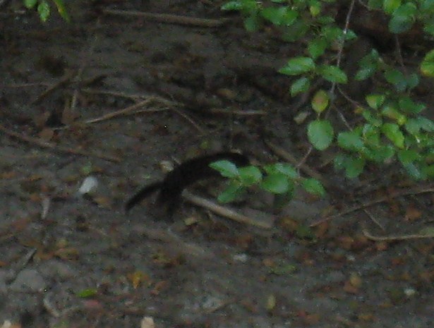
Where I saw this blurry guy swimming across the creek.

I yelled for Ron to come quickly and he identified it as a mink!  And he should know since his uncle had a mink farm and he helped care for them several summers when he was a lad.

Another blurry picture.  It really moved quickly.

We stopped at the overlook for Ross Lake which extends 24 miles to the Canadian border.  Uh-oh, it looks like another fire there in the distance.

I think we need to come back earlier in the summer when these lovely peaks are snow-covered and before fire season.

We had signed up for a dinner/tour called 'Newhalem at Night'.  After a 'Dam Good Chicken Dinner', we headed out for our walking tour and were greeted by the sight of another fire up on the ridge.

We learned about the Skagit Hydroelectric Project which consists of three dams in the valley - Ross, Diablo, and Gorge.  Then we wandered through the unusual light show at Ladder Creek Falls.

It seems that Mr. Ross, who was in charge of the project in the early 1900s, wanted to show off a beautiful use of electricity.  Here is a short video of the changing colors on the water.


Needless to say, the next morning we got the heck out of there.  Ironically, we were so happy to have a fire ban in the campground, but nobody told Mother Nature that lightning strikes were not allowed.


Thursday, August 13, 2015

Hot?

As we headed inland, I assumed we would be gaining elevation through the Cascade Mountains.  Although this will be true down the road, the first part of our trip has been through the Skagit Valley.  Weather.com has been predicting a heat wave with temperatures in the high 90’s which made me think we needed hookups to run the air.  However, the best laid plans of mice and men . . ., and all that.  Anticipating hookups, we confidently arrived at Howard Miller Steelhead Park in Rockport on a Monday to discover that the whole park had been rented out for the week! 

A bit apprehensively, we followed a nice young man’s suggestion and detoured 6 miles south to another Skagit County primitive park overlooking the Sauk River.  If we couldn’t have AC, we would just hunker down in the trees.  We found the biggest pull-through site we’ve ever seen.  

See our rig barely visible in the distance?  That’s not the road, but our site, and there’s about 50 more feet of it behind the rig.  Is it any wonder that people keep driving in thinking it's empty?

For some reason, this fern outside our dinette window caught my eye.

The Skagit River is a pretty gray-green color due to glacial silt in the water.

Oh, another view of Mt. Baker!

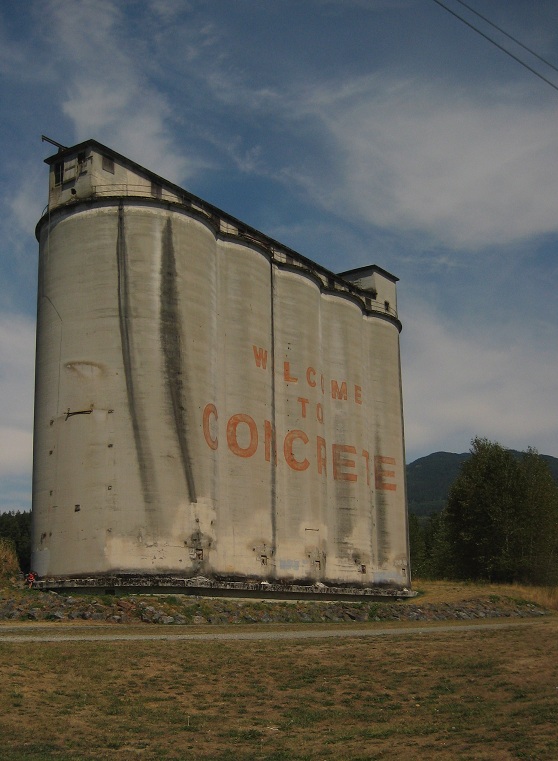
The town of Concrete was so named because of the cement companies that operated there in the early 1900s.

It’s now a small town of 900 residents with this sweet little church.

The concrete bridge is listed on the Washington State and National Historic Registers.  When completed in 1918, it was the longest single span concrete bridge in the world.  Also, it’s very attractive.

We stopped at Sauk Mountain Pottery and spent an interesting ½ hour talking to the owner.  He built his artistic house from the ground up.

I didn’t buy anything, but I was very tempted.  His pottery is beautiful, unique, and reasonably priced.  I just can’t get over my inbred cheapness and excessive practicality.

We also stopped at the birthplace of my favorite cereal.  I was expecting to see a production facility, but was told that General Mills bought them out years ago and now it comes out of Minnesota.

As for the heat scare, that's all it was.  The first day it got up to the mid 80s and the next it didn’t even reach 80!  It was gorgeous at our woodland site.


Wednesday, August 12, 2015

In Search of the Mountain

Finally the day arrived for us to begin our journey east on WA 20 into the Cascade Mountains.  As soon as we left Sedro-Woolley, I was snapping pictures of the pretty Skagit Valley out the front window. 

We only went 24 miles to Grandy Lake County Park - $10, no amenities, unless you consider a port-a-pot an amenity.  It’s just perfect for us and, as an added bonus, you can have all the blackberries you can pick.  We dropped off the RV and took the car north on Baker Lake Road in search of the perfect picture of Mt. Baker.  The first mountain sighting was Mt. Shuksan and, yes, I am standing in the middle of the road.

(I really do miss my 10x zoom.)

The first good sighting of Mt. Baker was while crossing the Upper Baker Dam.  There was no stopping on the one-lane dam, so I just stuck my camera out the window.  Uh-oh, it looks like the clouds are gathering.

I had this idea that if we hiked the trail on the east side of the lake, we would see Mt. Baker with the lake in the foreground.  The sign at the trailhead seemed to confirm this when it said we would have glimpses of the mountain and lake.  So off we went.

When we spotted this lovely cedar tree, I thought I’d again try the shot where ‘we’ broke the camera.  This time I took it with the strap securely around my wrist.

That went well, but I’m afraid the sign had exaggerated the views.

On the way back to the dam, Ron found a spot where we could get down to the lake for a shot of Mt. Baker and the dam, but that still wasn’t perfect.

Baker Lake is gorgeous, even with the orange buoys.

We drove up the west side of the lake, stopping at all the boat ramps to admire the scenery.

This young man created his own boat using a piece of wood about 10 feet long and 18 inches wide.  Pretty clever, I’d say.

Finally we found that the best view of majestic Mt. Baker was where the road crossed Boulder Creek.  Who would have thought?

Ron suggested we take a selfie on the only day I didn’t bring my phone.  Do you know how hard it is to take a selfie with a camera?  It took us a few tries.

Later when we returned to the RV, Ron broke out the grill and made us hamburgers. 

While I took some pictures of pretty Grandy Lake.

We couldn’t remember the last time we parked at an actual campground, but we’ll be doing that a lot on this part of our trip.  We love it, especially since there is a fire ban right now.  Yeah!


Tuesday, August 11, 2015

Sedro-Woolley

The cute town of Sedro-Woolley is the jumping off point for WA 20 through the North Cascades.  We stopped at the visitors center and got lots of good information for our big adventure.  I've been looking forward to this drive for years and I hope I haven't over-anticipated.  You know, where you expect so much that you're bound to be disappointed.

We stayed one night in the city park, $20 for water and electric, so we'd be fully charged for our trip into the wilds.  Ron got a haircut so nobody would mistake him for Sasquatch.

Like many small towns, Sedro-Woolley has some interesting murals around town.  This huge one is hard to photograph.

I'll crop it so you can see some of the detail.

Ron liked the old drugstore one.

But Sedro-Woolley has gone above and beyond the norm.  Each year in July, they have a chainsaw carving competition.  The astounding results are all over the downtown area.


Each piece is carved out of a cedar log, 8 feet tall and 3 feet in diameter.

How do they do such intricate detail with a chainsaw?

I would love to see that.