Our next stop was Flaming Gorge National Recreation Area and flaming it is!
If I had a boat, this is where I would take it. When at capacity, the reservoir is 91 miles long, with gorgeous cliffs and interesting inlets. Here's the topo map from the visitor center at the dam.
(Don't let the size of those animals mislead you.)
The first picture was taken from the Red Canyon overlook. Here's the view in the opposite direction.
You need to watch your step at the overlook.
Then we stopped at the Sheep Creek Overlook for more 180 degree views. Here's the reservoir side.
And perhaps even prettier is Sheep Creek Canyon.
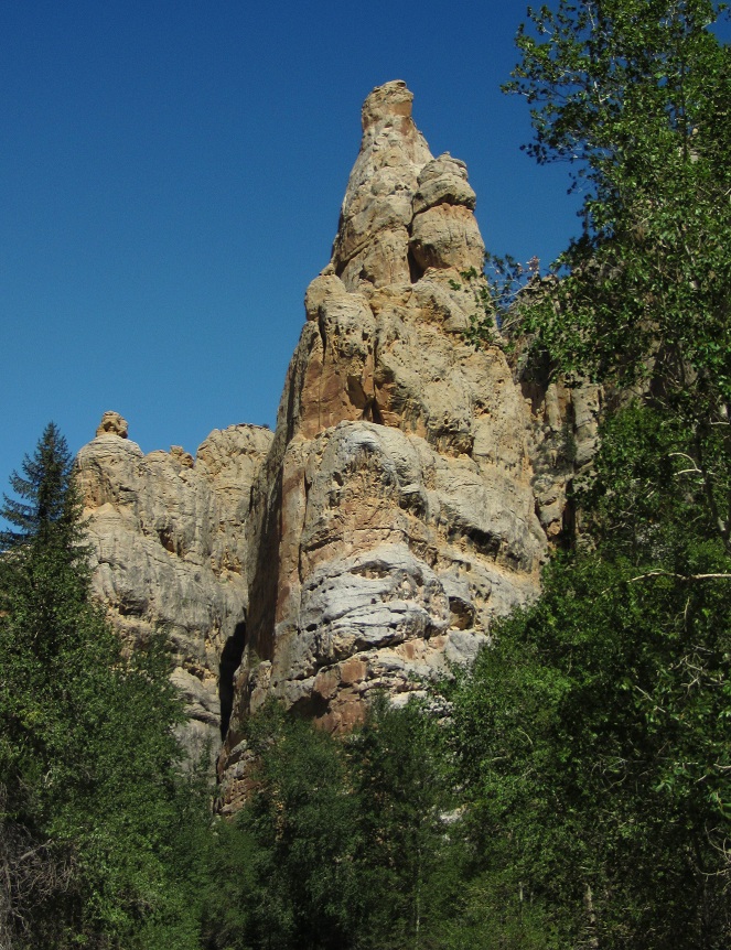
We took the Sheep Creek Canyon loop to see even more cool rock formations. Here's Tower Rock.
I guess you know by now that I really like rocks and if they are colorful and/or swirly, that's even better.
We ended the day by stopping at Moose Lake. We didn't see any moose, but did see something pretty special. An osprey dove right in front of us and snatched his dinner out of the lake. Here's my perfect shot of the osprey and fish.
Yep, I think I should send that one to National Geographic. I'm sure they would want to publish it.
Saturday, September 8, 2012
Thursday, September 6, 2012
Dinosaur National Monument (part 2)
After two wonderful months in Colorado, on September 1st, we entered Utah. Although we were sorry to leave Colorado, Utah is an RVer's paradise with 2/3 of the land owned by the federal government and, therefore, public land. That's a lot of beautiful country to see and appreciate.
First we visited the western, or Utah, side of Dinosaur NM.
We were greeted by this fellow in front of the visitor center, which Ron noticed had a similar shape to the cliffs behind it.
In the summer, a shuttle runs you up to the main attraction. This building protects a wall of dinosaur bones from 149 million years ago. The quarry exhibit hall was opened in 2011 after the previous building was deemed unsafe and closed in 2006.
When I first saw the dinosaur quarry about 10 years ago, I was convince it was fake. I'm such a skeptic.
The reason why there is such a concentration of bones is because this was once the bed of an ancient river. When a long drought killed many dinosaurs, many of them expired in or near the dry river channel. Subsequent rains and mud buried the bones and created this phenomenon. Between 66 and 2 million years ago, a great uplift occurred and pushed the former riverbed to its current 60 degree angle.
It's truly an amazing sight.
We even touched a 149 million year old dinosaur bone. What a thrill.
They also have some replicas and a really cool mural.
Later we drove around and admired the colorful landscape.
First we visited the western, or Utah, side of Dinosaur NM.
We were greeted by this fellow in front of the visitor center, which Ron noticed had a similar shape to the cliffs behind it.
In the summer, a shuttle runs you up to the main attraction. This building protects a wall of dinosaur bones from 149 million years ago. The quarry exhibit hall was opened in 2011 after the previous building was deemed unsafe and closed in 2006.
When I first saw the dinosaur quarry about 10 years ago, I was convince it was fake. I'm such a skeptic.
The reason why there is such a concentration of bones is because this was once the bed of an ancient river. When a long drought killed many dinosaurs, many of them expired in or near the dry river channel. Subsequent rains and mud buried the bones and created this phenomenon. Between 66 and 2 million years ago, a great uplift occurred and pushed the former riverbed to its current 60 degree angle.
It's truly an amazing sight.
We even touched a 149 million year old dinosaur bone. What a thrill.
They also have some replicas and a really cool mural.
Later we drove around and admired the colorful landscape.
Tuesday, September 4, 2012
Dinosaur National Monument
Dinosaur NM straddles the border of Utah and Colorado and today we saw the Colorado side. The eastern part of the monument doesn't have any fossils, as they keep reminding you, but what it does have is spectacular scenery. I had never stopped there and didn't realize what I was missing.
From the visitor center, the road steadily climbs by colorful cliffs.
The views from the overlooks were like being on top of the world, but too hazy for pictures. (I heard that the fires in Idaho won't be out until October.) So instead I went for the closeup.
We drove to the end of the road and hiked the Harpers Corner Trail - two miles round trip, along a ridge with views of the canyons below.
(Obviously named after Ron's grandson.)
I had pictured the trail running along the very top of the ridge with drop offs on each side, especially since the docent in the visitor center asked if we were afraid of heights. Instead it wound through junipers, pinyon pines, and douglas firs, but with plenty of views through the trees.
This is our first good view of Steamboat Rock. The Yampa River flows into the Green on the other side of it. You can see it coming in from the top of the picture. It would be much easier to see with more water in the rivers.
I decided to use my 10X zoom to see what the tiny dots were at the base of Steamboat Rock.
Well, I still couldn't tell for sure, so I cropped the life out of it.
Hey, that looks like fun!
This was the only spot on the trail where you might have a problem if you suffered from acrophobia.
But the view at the end was gorgeous. If you click on this, you can see the Green River coming in from the upper left, the Yampa from the right and the Green after the confluence along the bottom of the picture.
The land here had certainly been pushed up in some unusual ways.
The view on the other side was just as interesting with the Green River continuing on its way. Ooops, where did those rain clouds come from?
Luckily, the rain missed us. On our way back out of the park, we stopped at the overlook for the Echo Park road. It was posted as a high-clearance road, which our Saturn is not, and goes down into that interesting landscape to Steamboat Rock.
The road really didn't look bad and I wondered if they had improved it. Next trip.
Next post - the Utah side and dinosaur bones!
From the visitor center, the road steadily climbs by colorful cliffs.
The views from the overlooks were like being on top of the world, but too hazy for pictures. (I heard that the fires in Idaho won't be out until October.) So instead I went for the closeup.
We drove to the end of the road and hiked the Harpers Corner Trail - two miles round trip, along a ridge with views of the canyons below.
(Obviously named after Ron's grandson.)
I had pictured the trail running along the very top of the ridge with drop offs on each side, especially since the docent in the visitor center asked if we were afraid of heights. Instead it wound through junipers, pinyon pines, and douglas firs, but with plenty of views through the trees.
This is our first good view of Steamboat Rock. The Yampa River flows into the Green on the other side of it. You can see it coming in from the top of the picture. It would be much easier to see with more water in the rivers.
I decided to use my 10X zoom to see what the tiny dots were at the base of Steamboat Rock.
Well, I still couldn't tell for sure, so I cropped the life out of it.
Hey, that looks like fun!
This was the only spot on the trail where you might have a problem if you suffered from acrophobia.
But the view at the end was gorgeous. If you click on this, you can see the Green River coming in from the upper left, the Yampa from the right and the Green after the confluence along the bottom of the picture.
The land here had certainly been pushed up in some unusual ways.
The view on the other side was just as interesting with the Green River continuing on its way. Ooops, where did those rain clouds come from?
Luckily, the rain missed us. On our way back out of the park, we stopped at the overlook for the Echo Park road. It was posted as a high-clearance road, which our Saturn is not, and goes down into that interesting landscape to Steamboat Rock.
The road really didn't look bad and I wondered if they had improved it. Next trip.
Next post - the Utah side and dinosaur bones!
Saturday, September 1, 2012
Lake Agnes
Lake Agnes has to be one of the most beautiful mountain lakes in the U.S. It is located in the Colorado State Forest (who knew there was such a place?) about seven miles east of Gould off CO 14.
The price to experience this wondrous place is $7 per car and I didn't even mind paying. Even the view from the parking lot is pretty.
The trail is short at only 8 tenths of a mile (each way) and moderately steep with a 480 foot elevation gain. With the trail beginning at over 10,000 foot elevation, you can imagine we did some huffing.
But we made it and just look at this perfect lake!
It has crystal clear water.
We carefully made our way around the edge of the lake. (See Ron up there?)
And had a snack while basking in all the beauty. Ron had a feeling that somebody was watching him.
I couldn't stop taking pictures.
On our way back home, we saw some pretty aspen trees heralding the coming of autumn.
Thursday, August 30, 2012
On Walden Pond
Well, not really. But we did stay for several days at South Delaney Butte Lake, about 10 west of Walden, CO. Another great place for Ron to use his Colorado fishing license and free, free, free.
Here we are parked at the base of Delaney Butte.
There were a few other people there. This guy had an inflatable boat and multiple fishing poles.
The wildlife entertained us. This mommy duck stayed between her babies and the white-faced ibis (or is that ibises?)
We drove around one day and appreciated this pastoral scene.
And I was thrilled when this Pronghorn posed for a picture alongside the road.
We even spotted a moose in downtown Walden.
But back to the title, closer to town is Walden Reservoir. However, with the water being low, I commented that it was more like a pond.
Here we are parked at the base of Delaney Butte.
There were a few other people there. This guy had an inflatable boat and multiple fishing poles.
The wildlife entertained us. This mommy duck stayed between her babies and the white-faced ibis (or is that ibises?)
We drove around one day and appreciated this pastoral scene.
And I was thrilled when this Pronghorn posed for a picture alongside the road.
We even spotted a moose in downtown Walden.
But back to the title, closer to town is Walden Reservoir. However, with the water being low, I commented that it was more like a pond.
Monday, August 27, 2012
Another Great Spot
Next we moved to a State Wildlife Area a couple of miles west of Hot Sulpher Springs, CO. This is a great boondocking spot for fishermen since it's right on a section of the Colorado River designated 'Gold Medal Waters.'
I took this out the front window of the RV - Ron could have almost fished out the window. The bridge is US 40 and the coordinates for the turn to the spot are 40.05312, -106.13277. I wouldn't advise taking anything bigger than our 30' rig into the area, but there is a place to disconnect as soon as you turn off the highway. Luckily Ron is fearless.
We saw beavers swimming by every evening and they were a lot closer than the one we saw at Lower Cataract Lake, but it was too dark for pictures. However we found evidence of just how busy these beavers have been.
After all their work, they must have been upset when the tree fell away from the river, but we could see they had stripped off all the branches.
We took a day trip to Grand Lake, supposedly where the Colorado River begins. I think that's up to debate, but it is the largest natural lake in Colorado.
We did the short .3 mile hike to Adams Falls, one of the inlets to the lake. Not the most impressive waterfall.
But if you continue about another .3 mile, you come to this lovely meadow.
It seemed that everyone we passed had seen moose, and so did we. However the mommy and baby were so far away, I don't think it really counted.
Another day, after taking an exploratory drive, I had Ron drop me off in Byers Canyon, a short but spectacular gorge, the beginning of which you can see in the first picture.
But here's where my father will be really proud of me - I waited around for a whole hour to photograph trains! Here comes one now. It looks like I might have gotten a bit excited and jiggled the camera.
But my goal was to capture a passenger train. We had seen one go by about 3:30 the day we arrived, so I was hoping it was on a daily schedule. Sure enough, at almost exactly 3:30, I hit the jackpot.
I took this out the front window of the RV - Ron could have almost fished out the window. The bridge is US 40 and the coordinates for the turn to the spot are 40.05312, -106.13277. I wouldn't advise taking anything bigger than our 30' rig into the area, but there is a place to disconnect as soon as you turn off the highway. Luckily Ron is fearless.
We saw beavers swimming by every evening and they were a lot closer than the one we saw at Lower Cataract Lake, but it was too dark for pictures. However we found evidence of just how busy these beavers have been.
After all their work, they must have been upset when the tree fell away from the river, but we could see they had stripped off all the branches.
We took a day trip to Grand Lake, supposedly where the Colorado River begins. I think that's up to debate, but it is the largest natural lake in Colorado.
We did the short .3 mile hike to Adams Falls, one of the inlets to the lake. Not the most impressive waterfall.
But if you continue about another .3 mile, you come to this lovely meadow.
It seemed that everyone we passed had seen moose, and so did we. However the mommy and baby were so far away, I don't think it really counted.
Another day, after taking an exploratory drive, I had Ron drop me off in Byers Canyon, a short but spectacular gorge, the beginning of which you can see in the first picture.
But here's where my father will be really proud of me - I waited around for a whole hour to photograph trains! Here comes one now. It looks like I might have gotten a bit excited and jiggled the camera.
But my goal was to capture a passenger train. We had seen one go by about 3:30 the day we arrived, so I was hoping it was on a daily schedule. Sure enough, at almost exactly 3:30, I hit the jackpot.
Subscribe to:
Posts (Atom)

.jpg)