When we left our spot outside of Ketchum/Sun Valley, we headed farther north. After all, it was getting warm. Just outside of Ketchum, we entered the beautiful Sawtooth National Recreation Area.
At first the ascent to Galena Pass was pretty gradual, following the Big Wood River.
But soon we left the river behind on our way up to the pass.
The first sight of the Sawtooth Mountains is always lovely, although we were a little late for the perfect amount of snow.
Sawtooth NRA allows boondocking (or dispersed camping) just about anywhere. We love it! We picked a spot near pretty Perkin's Lake.
On the north side of the pass is the headwaters of the mighty Salmon River. We took the car and drove as far up as possible, but couldn't make it to the actual headwaters. At this point we turned around.
Also at our turn around spot was a campground. Funny thing, you have to drive through the Salmon River to get to the campground.
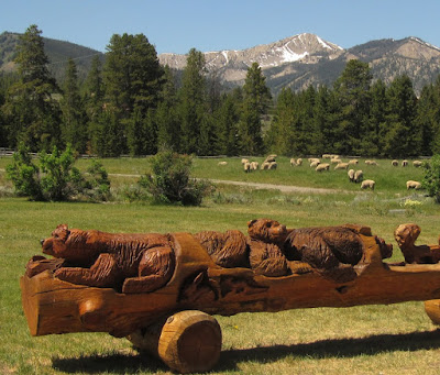
On our way back to the RV, we stopped to admire this log carving. Pretty cute, huh?
Thursday, June 30, 2016
Sunday, June 26, 2016
Living on the Fringe
Although we are usually living on the fringe while traveling, it seems more pronounced here. For the past five days, we've been staying in the national forest just four miles from high class Sun Valley, Idaho. Here's our view back down Trail Creek Road with the ski slopes on Bald Mountain in the distance.
Ron calls the area 'yuppity', but, to be honest, all the locals we've talked to have been extremely friendly. He's been fishing and gold panning, but so far we still haven't eaten any fresh fish or gotten rich. He thinks the water is just running too fast. We're moving to a lake tomorrow.
He did take some time out for a couple of hikes. We did part of the Trail Creek Trail which is close to where we're parked.
And another day we went to the very popular Adams Gulch where we hiked a loop. The first half was along open meadow with wide-open views.
Then we looped back through the woods - nice as it was getting warm.
There were lots of pretty columbine blooming along the trail.
And wild lupine, both the common purple and some white ones too.
Lupine must really do well in this climate. The domestic version was gigantic in the neighborhood yards.
I guess Ron isn't the only one who thinks the area is 'yuppity'. I laughed and laughed at what somebody added to the pedestrian crosswalk sign.
Friday, June 24, 2016
Fission and Fishin'
Diana left us in Idaho Falls, but hopefully we'll see her soon. Meanwhile Ron and I are slowly making our way across Idaho. We made a stop at the EBR-1 Atomic Museum which was way more interesting than I expected.
Situated in the middle of nowhere, EBR-1 was the first power plant in the world to produce usable electricity using atomic energy. On December 20, 1951, four light bulbs like these were lit during the historic event.
I know that doesn't sound really impressive, but until 1964, when the reactor was decommissioned, many discoveries and advances in the field were made there. In 1966, President Johnson designated EBR-1 as a National Historic Landmark.
There was a self-guided tour with good signage and pamphlet. And usually there is an available tour guide, but that person was sick that day.
My favorite part was the remote arm where one could test their their dexterity. Ron did very well.
If you ever get in the area, you'll find that the site is well worth a stop.
Ron has purchased an Idaho fishing license, so we've been staying at free locations near various waterways, of which there are many.
We parked a couple of days along Silver Creek. I took this out the RV window.
Nearby was this gorgeous field of rapeseed. I bet more people would grow it if it didn't have such a horrible name.
When we saw the weather was heating up, we moved to a shady spot near the Big Wood River.
He hasn't been having a lot of luck, but he sure looks the part.
During a break, we checked out Sculptured Canyon. About 7000 years ago, water from melting glaciers sculpted the Shoshone lava field into interesting cliffs and potholes.
Wednesday, June 22, 2016
Idaho Falls
It's surprising how quickly the blog falls behind. I do have a small excuse, we were without internet for a couple of days, but that doesn't explain a whole week of silence.
After Yellowstone, we spent a few days in Idaho Falls which we all agreed is a perfect-sized town. It has all our favorite stores, including Fred Meyer where Diana and I splurged and each bought pants!
The Snake River goes through town and is half dammed and half natural.
There's a lovely river walk that goes on for miles.
Nearby is Hell's Half Acre, where, 4000 years ago, lava oozed from a deep crack in the earth's crust, instead of from a fiery blast.
But wait! I just realized that I skipped something. On our way from West Yellowstone to Idaho Falls, we took the Mesa Falls Scenic Byway and enjoyed pretty 114-foot Upper Mesa Falls.
Where we witnessed a sweet marriage proposal.
And we were surprised to see a sign advertising a man wearing cheese. Imagine that.
Tuesday, June 14, 2016
Yellowstone (part 5)
I promise this is the last of our Yellowstone adventures. Continuing around the lower loop, we stopped at the viewpoint for Sulphur Caldron. As the name implies, it was a odoriferous experience.
And we stopped at Mud Volcano which is not too exciting.
Although the bison must really appreciate it by the number of hoof prints.
Dragon's Mouth Spring is another spot that has to be seen and heard to be appreciated. I could hear the dragon roaring all the way from the parking lot.
The dragon didn't seem to bother this killdeer, but he sure heckled the tourists.
Finally we made it to beautiful Yellowstone Lake, a refreshing change.
I was surprised to see this bald eagle flying through the visitors center. Tee-hee
That area obviously had a much more recent fire. It's interesting how nature renews itself.
Our final stop was at West Thumb Geyser Basin where this little guy was way too close to the boardwalk. How can you stay 75 feet away from the wildlife when the wildlife won't cooperate?
The highlight there was beautiful Black Pool.
Black? Really?
I'll finish with a view from our campground site. The Madison River flowed right by and one evening I looked out and thought a mountain had suddenly appeared. Silly me, can't tell a cloud from a mountain.
Monday, June 13, 2016
Yellowstone (part 4)
I realize I'm probably posting way too many pictures of Yellowstone, but this way I'll be able to reminisce when I'm old(er) and gray(er).
On our final day in Yellowstone, Ron wanted to drive the whole lower loop. I pointed out that it's a looong way around (96 miles, plus the 14 miles from West Yellowstone), but he asks for so little. Diana did her own thing while we made the trip.
We were able to hit a couple of spots that were too busy the day before, like Artists Paintpots. The park really needs to expand the parking lot at this location. It would be okay if it was just a viewpoint, but there's a mile-long roundtrip walk out to the paintpots.
All the percolating mud pots were interesting, but not much of a picture.
Next we were able to get into Norris Geyser Basin, which it seems they close at intervals when the cars get too backed up. Honestly, if they're not going to make the parking lots big enough for the hoards of visitors, then they should have a bus system like many of the other parks. I'm all for the propane buses, myself.
Norris Basin has two boardwalk loops, Porcelain Basin and Back Basin. We first took the Back Basin trail as far as Steamboat Geyser, the world's tallest active geyser. Steamboat has infrequent eruptions of more than 300 feet, twice as high as Old Faithful. Of course, it's not at all faithful with its last major eruption in September of 2014. We decided not to wait around. It did sputter a bit for us.
/
We passed Emerald Spring which was a disappointing non-emerald color.
The ranger we met told us that it's an example of how the area is always changing. It seems this color change happened just recently.
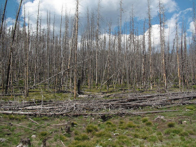
Another method of change in the park is fire. It's easy to spot when all the trees are the same petite size with a few surviving tall trunks.
We switched to the Back Basin and completed that loop. Guardian Steam Vent also recently changed - this one from a geyser to a steam vent. And what a vent it is! It really sounds like a steam engine.
I tried to capture it in a movie, but the sound just wasn't there. Although you can at least see the massive amount of steam that pours out of the vent.
Crackling Lake looked very peaceful, but don't let that fool you.
The day before, a man had left the boardwalk and fallen into a boiling hot spring right there in Norris Basin. After attempting to recover the body, the next day park rangers announced there were no remains left to recover. What a horrible way to go!
I'll end here with this little guy who was giving everybody the business from atop the doorway to the visitors center.
Sunday, June 12, 2016
Yellowstone (part 3)
Our second day in the park began with us hurrying to Yellowstone Falls. There was a hike there that Diana wanted to try which involved lots of steps to the base of the Lower Falls, so of course we were thrilled to join her. Unfortunately, it was closed. Added to the closure yesterday, I think she was beginning to get a complex.
So we lined up for the picture of the Upper Falls.
Then went to Artist Point for the classic shot of Lower Yellowstone Falls.
Let me zoom in some. It almost looks fake, doesn't it?
Don't forget to turn around. The colorful canyon is gorgeous too.
We drove to Lookout Point on the North Rim where Diana took the obligatory picture of us with the Lower Falls.
If you're really observant, you noticed there was a patch of snow on the previous picture. I confess I erased it out of this one because it was just too distracting. LOL
And I took what is probably the worst picture ever of a nesting osprey.
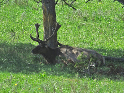
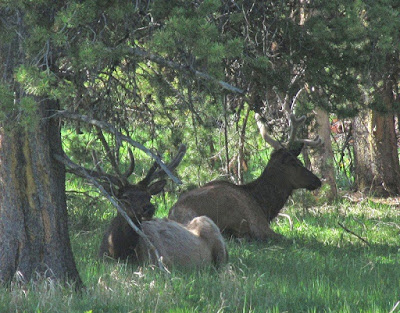
While driving between the South and North Rims, we saw lots of cars pulled over and knew something was up. Sure enough, some bull elk were resting in the shade - not great for pictures, but we'll take what we can get.
As you probably know, much of Yellowstone NP is a caldera from old volcanic eruptions. I was interested in this map in the visitors center which shows how the volcanic hotspot moved over the years due to movement of the North American Plate.
On our way home, we stopped at Gibbon Falls where we unsuccessfully looked for apes..
Subscribe to:
Comments (Atom)


