Wednesday, August 17, 2011

Mt. St. Helens - West Side

After more than a month in glorious Oregon, we caught back up with our WIN friends in tiny Toutle, Washington, where someone had arranged that we would stay in a field next to the school. This is a win/win for these little towns, as we contributed over $300 to the school directly in addition to any other purchases we made in the area.

The benefit of this location, is that it is right on the way to Mt. St. Helens. Of course they probably didn't think it was a benefit in 1980 when the mountain erupted and the Toutle River carried logs, ash, and rubble into town.

But today she's calm and we drove over several of these lovely bridges.


Overlooking the Toutle River where all the debris changed the valley so drastically.


Up to Johnston Ridge Observatory for this view of the mountain. It was a little cloudy, but still an impressive sight.


The observatory (really more of a visitor center) is very informative and the movie is one of the best I've ever seen. It must have been designed to keep the kids awake with a lot of loud noises and special effects.

Then we took the walk uphill through the gorgeous wild flowers and tress snapped by the blast.


Wow!


On the way back down, we stopped at Coldwater Lake which didn't even exist before Mt. St. Helens blew and formed a natural dam.


At the little museum in nearby Castle Rock, they had these 'before' and 'after' pictures.


Isn't Mother Nature amazing?

Sunday, August 14, 2011

Quick Stop

While we were in Oregon, we wanted to buy new tires for the RV (no sales tax.) Since we were about to leave this wonderful state, we realized it was now or never. Please note, during the economic downturn in 08-09, we did our part to help by buying a house. With the recent crisis, we bought tires, which were almost as much as a house. Ron called places in the Portland area and we settled on six Continental tires (which are made in the U.S., thereby saving someone's job for a day.) We stopped for one night at the Gresham Elks and were happy to participate in their taco night. Yum.

Even though we were there for a purpose, we still just had to take the scenic drive along the Columbia River. The viewpoint was a little disappointing with an overcast sky.


But the waterfalls were spectacular. This is Bridal Veil Falls. (I wonder how many waterfalls are named Bridal Veil or Bridalveil.)


Multnomah Falls is the most famous of the Columbia gorge waterfalls and I promise is the last Oregon waterfall I will post. Depending on who you believe, it's either 611 or 620 feet tall. Either way, it's quite a sight.


I took this of a picture in the visitors center. I don't think I would have stood on that rickety looking bridge.


"What is Ron doing?" you may ask.


Just trying to obey the sign.

Saturday, August 13, 2011

Bagby Hot Springs

About 45 minutes south of Estacada, Oregon, is the most elaborate natural hot springs setup I have ever seen. After missing a turn and taking the scenic route up a mountain, I made a note of the coordinates to post here. But, wouldn't you know, I lost that paper. It's about 45 minutes southeast of Estacada, mostly down 224. Ask in town for better directions.

Oregon towns seem to love murals which is nice because I do too. Estacada had some vivid ones. I liked this Shakespearean based one.


And this lovely Oregon scene. (The clouds are real, not part of the painting.)


Then it was off to Bagby Hot Springs.


The beautiful 1 1/2 mile trail is through an old growth forest.


With some super-constructed bridges.


The hot (very hot) water comes from this tiny spring and runs through a log trough . .


Into private log tubs like this one or round group tubs. If the water is too hot, buckets are available to use for fetching cold water from a nearby source.


As you can see, there are plenty of big logs to use for construction.

Now, I am not actually a fan of hot springs. Not only do I not enjoy sitting in very hot water, all I can think about is 'bacteria.' I know, I'm pathetic. But Bagby is worth visiting for the lovely hike and the amazing construction that has been done there as a cooperative effort of the locals and the forest service. Check it out if you're ever in the area, just not on a weekend like we did. Estacada is southeast of Portland.

Wednesday, August 10, 2011

Oregon City

Our next move was to Oregon City, the oldest incorporated city west of the Rockies and the end of the famous Oregon Trail. The trail was 2040 miles long, passed through six states and was used by an estimated 200,000 brave pioneers from 1843 to the 1860s.

If interested, you'll have to click on the map to see the trail route.

Boggles the mind, doesn't it?

We stayed at the Oregon City Elks Park which is about 15 miles south of Oregon City and right along the Mollala River. Nice.


But the road in was a horror. We would have appreciated a little warning, but when I called to check for an available spot, the campground host didn't say a word. The road was one lane, twisty and hilly with no visibility of oncoming traffic. If we had known, we would have unhooked and I would have driven ahead to block traffic, which is what we did on the way out. But once we had committed ourselves, it was too late.
Luckily, the road wasn't very long, but once again, we didn't know that coming in.

Once we stopped shaking, we took the car to Oregon City to see the 'End of the Trail Interpretive Center', listed as a 'gem' in the AAA book. Surprise, surprise, due to the economy it was closed. BUT at the visitors center, we found out there is a free trolley that takes visitors around town. Did I mention it is free?


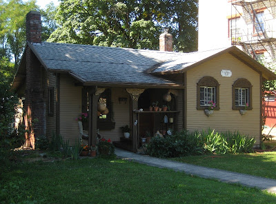
The driver was great, entertained us, and pointed out points of interest. This was my favorite historical house.

He even waited while we checked out Willamette Falls and the very unique dam on the Willamette River.


After the tour, we took the only vertical street in North America, Elevator Street. In Oregon City's early years, most of the city was located at river level. But as the city grew, houses were built atop the 90 foot bluff. In 1915, the first Municipal Elevator was built to carry pedestrians and bicyclists between the two town levels. It was replaced in 1955 with the current elevator. And did I mention it is free?

There is an observaion deck at the top with great views of the surrounding city and the Willamette River. It also has panels with pictures that change as you move past them. What I found interesting was that most sets of them showed views of the same scene from years ago and recently.

Here is the set showing 7th Street from the bridge to the elevator. Look at the old cars and original elevator.


Compared to the more recent scene and the new elevator.
I also thought it strange that it looks like the same 'right turn only' sign in both pictures. That must be one well made sign.

Monday, August 8, 2011

Silver Falls State Park

As I mentioned in the previous post, we stopped in Silverton mainly to visit nearby Silver Falls SP. The Silverton Elks kindly allowed us to park for two nights, even though their parking lot was minimal. Although we really appreciate their kindness, we don't recommend this spot to our fellow Elk RVers. We were right next to a busy corner with a four-way stop and the fumes gave us both a headache. Fair warning.

If not for that problem, we would have liked to stay longer. Silverton is another one of those cute Oregon towns and we were parked just a block off Main St. They have interesting murals all over town and we did a walking tour to see them.

This is my favorite.


On to the park which contains ten unique waterfalls that can be viewed via a trail along Silver Creek. I estimate the trail to be four to five miles and the best way for us to see everything would be to begin at the upper end and walk down stream. Unfortunately, we didn't have another car to leave at the lower end, so we stopped at different trailheads and climbed down to creek level and back up THREE times. But we did manage to see seven of the ten waterfalls.

This is the South Falls, the tallest single drop at 177 feet. The falls flow over basalt lava atop softer, older rock. This softer rock wears away creating pathways behind some of the falls. You can see little people on the path in this picture.

I think we might have become jaded with all the massive waterfalls we've seen. Although the height of this waterfall was impressive, Silver Creek, at least at this time of the year, doesn't have the shear volume of the McKenzie.

After walking behind the falls, looping down to the creek and back up, we headed for the next trailhead. Then it was down to the creek again where we wondered about this clearly over-constructed 3-foot bridge. Gorgeous, but how much weight did they plan on it holding?


Ah, here's Middle North Falls. (Why not just Middle Falls?) We could get right next to this one, so it seemed more impressive and I really like all the greenery and the look of the lava walls.


On we went to Drake Falls, which was hidden behind some trees, but I was distracted by this flower. It looks like something in the pea family.


Next was Lower North Falls which was interesting because of how the water just shimmered along the rock. It would make a great waterslide - just watch out for those giant logs at the bottom.


Ron and I decided to do the tourist picture in front of Double Falls.


For sure we're not in the high desert anymore. Look at all the moss growing on this tree.


Finally we ended at North Falls with another hike down and up. I picked this picture to post because of the tree. The waterfall is 136 feet high and this tree extended way out of the picture. We estimated it had to be at least 180 feet, but what really amazed us was that it wasn't very big around.

So what have we learned here? Go to Silver Falls State Park in the spring or early summer and take two cars. It is a special place especially for waterfall lovers.

Saturday, August 6, 2011

Oregon State Garden

We moved to the Silverton Elks to be close to Silver Falls State Park - a place I've wanted to see for years. But first we visited the Oregon State Garden, right here in Silverton.

It's only been open for ten years, but it's well worth a trip.


A tram takes you around and the driver explains each area. We took that first so we would know our way when we walked. If the driver hadn't told us this was a peacock, I don't know if we would have recognized it.


I won't bore you with lots of flower pictures, but I did admire this double daylily.


And here's a snapdragon that's taller than Ron.


Here they were demonstrating a 'green' roof. Ron said we could try it on our shed in Mesa, but he thought the dirt might be a little heavy.


But on to the fun stuff - the Children's Garden.


These trees were labeled as Weeping Giant Sequoias, but the tram driver called them Dr. Seuss trees.


How about these pot people?


And flower 'bed' complete with nightstand.


But my very favorite was the train garden. I loved the train and all the bonsai trees, but the best thing was the horn on this baby. Just listen.

Thursday, August 4, 2011

Cascades Highway

Last Sunday we took the McKenzie-Santiam Tour Route. We began with breakfast at a restaurant in Sisters. After all, it was Sunday.

On the way to town, we stopped at the Mt. Washington viewpoint. It has a different look for the Cascade Mountains.


At the McKenzie Pass is a cool structure made of lava - the Dee Wright Observatory. It has a great view of the surrounding lava fields and mountains.


Here's Ron with North and Middle Sister. The little bump to the right is Little Brother - no kidding!


There are also several waterfalls along the route. This is Koosah Falls. According to the handout from the visitor center, it's supposed to be divided into two falls, but with the water volume currently so high, it filled in the middle.


From there it's a short hike along the roaring McKenzie River to Sahalie Falls.


And here it is - another massive flow of water falling 100 feet.


Whew! It makes me a little dizzy.